Feeds:
Posts
Comments

Posts Tagged ‘maps’

One thing I really miss with my neurological illness is being able to walk around a place and explore. I used to love wandering around St Andrews as an undergraduate, and Hawick and other Borders towns when I was even younger. When the illness started in 1994, when I was just 22, it didn’t stop me walking right away, though there were issues. Walking difficulties have increased over time, especially after my major relapse in 2004.

I now always use two sticks out and about, and can hardly walk any distance. Often I have to use my wheelchair. I have had a Blue Badge since 2001 for good reason. It does mean that when we go on overseas trips I am extremely restricted. I have to sleep most days anyway, but even on other days I need the help of taxis or similar to get any distance away from the hotel. In Venice I had a huge struggle walking to the nearest water bus stop. And when I go back to Hawick I can’t explore as I’d like to. On trips my husband becomes my roving eyes, exploring a city on foot, with digital camera in hand, on the days I have to sleep. That helps me “see” a bit more of a place. But there’s still a great sense of loss. And I know I will never recover this. My disease is progressive.

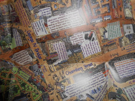
It’s particularly frustrating for me as an urban historian. So much of my academic research in the last 20 years has been on towns, and town development, especially in the seventeenth, eighteenth and nineteenth centuries. Luckily even with my disability I can make progress with a lot of documentary records – including digitised ones that I can access at home – and old maps and town plans. But there’s no real substitute for exploring a town on foot on the ground.

So yes, it’s sad, but I’m still able to explore my interests intellectually and academically. And life is still rewarding. Albeit not very mobile!

Read Full Post »

I recently bought Eleanor M. Harris‘s historical map of old Edinburgh, and have now had a good chance to look through it. I developed a strong interest in urban history, and Scottish urban history in particular, thanks to my PhD supervisor Professor Charles McKean, and also the taught PG Masters course I did beforehand in Cultural and Urban Histories 1650-1850. Plus being born in Edinburgh I was always going to be interested in this map!

Layers of Edinburgh folded map

Eleanor did all the artwork and wrote the text, including the calligraphy work, herself. It’s impressive how much she has squeezed in. The map unfolds to open with a so-called “short history” of the city, but it’s full of detail, from the earliest dates through to the 21st century, and gives a good potted account of developments over time.

Layers of Edinburgh short history

But the bulk of the content is on the map proper, on the other side, accompanied with notes about specific places and people. The emphasis is very much on the Old Town, so there isn’t for example any content on the map from Princes Street and further north, the area developed so much in the 18th century. What is there though is generally well presented, with colour coding to show different dates of development, as well as numbers which can lead to further information in the notes section on the back of the map.

Detail of Layers of Edinburgh map

If I have one criticism, it’s a small one, but much of the text on the map is written at all different angles, which can mean you need to turn it around a lot to read the contents. But that’s sort of necessary, given how much information has been squeezed in. And I don’t think it would be a problem using the map in the field so to speak.

For anyone with an interest in Edinburgh’s history, or urban history in general, I strongly recommend that you get hold of this map. If you can use it on the ground, and explore the streets with it to guide you, all the better. Copies of the map are available from Eleanor’s Etsy shop.

Read Full Post »

Blog about 24 hours at the recent SHARP book history conference at Philadelphia. I’m particularly intrigued by the talks about maps within books and mapping events within books. Wish I’d got to those!

Ellen And Jim Have A Blog, Two

WesternHemisphereOldMap
Geographies of the Book

Dear friends and readers,

During the all too short time (about a day’s length) I was able to be at the Sharp conference this year, held at the University of Pennsylvania, in Philadelphia, I enjoyed myself and heard some engaging informative papers — and gave one myself. Although I was able to attend the conference only briefly (as my husband was still recovering from an operation), I would still like to remember and share the gist of what I heard and experienced (as I did two years ago) and what I wish I could have been there for.

I arrived on Saturday, July 20th, around 2:00 pm, in time to attend two panels and in the evening go to a scrumptious banquet (at which there were Philadelphia mummers) and walk around the campus.

No surprise when I decided on “studies in the long 18th…

View original post 1,414 more words

Read Full Post »

The Guardian today posted a gallery of old map images, to tie in with a book newly out looking at maps charting the development of cities. There’s also a related podcast, where map experts Simon Garfield and Jerry Brotton talk about Maps from Ptolemy to Google.

I used maps a lot in my taught postgraduate MPhil degree which was studying Cultural and Urban Histories 1650-1850. Maps are a wonderful tool for viewing changing urban layouts, and understanding how towns worked in the past, figuring out the relationship between different areas and different functions, and also the relationship between a town and its surrounding hinterlands. Of course we relied on maps being created in the first place and still surviving today. I remember once finding a reference in the town council minutes to a map created of Montrose in Angus in the 1740s, but the map couldn’t be found now in the local archives. It may be lurking somewhere still though, as part of the unprocessed Montrose burgh collection held locally, and if it survived would be a fascinating glimpse into what the town looked like then.

There are lots of collections of old maps online. As a Scottish researcher I particularly like the National Library of Scotland’s digitised maps collection. This includes large area maps, for counties and countryside, as well as town plans, such as John Wood’s famous ones from the 1820s. Wood’s town plans capture Scottish towns in a period of considerable change, where old medieval structures and roads were often being transformed to a new urban layout. He also surveyed a number of more recently-established towns, which had quite a different physical layout from those with a medieval legacy.

I studied an Open University senior honours art history course last year, purely for fun, and for my end of course project I analysed Barbari’s groundbreaking plan of Venice circa 1500. There are various surviving prints of this map around the world. I saw one in the Museo Correr in Venice, the civic museum in the Piazza San Marco. And my jaw hit the floor when I walked into the room. This is a map on a massive scale, spread across six printed sheets, over a total area of 135 by 282 cm. The level of detail is staggering, but hard to appreciate when you’re standing at a distance from the map. Luckily there is a good digitised copy, thanks to a modern Venetian architect. I would recommend checking this out.

Read Full Post »